| Ecosystem |
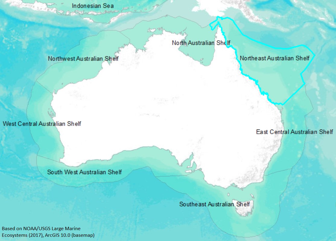
Northeast Australian Shelf |
| Type |
Sea/Bay/Gulf |
| Salinity |
saltwater |
| Other Names |
|
| Location |
|
LME SAU No 40. LME2002, LME2006, SAU 2008. |
11° S 22° S - 143° E 157° E |
|
| Location Map |
Northeast_Australian_Shelf.png |
| Size Ref |
|
River Length |
|
Area |
1281700 km2 |
Drainage Area |
|
|
| Depth |
|
Average Depth |
|
Max Depth |
|
Ref |
|
|
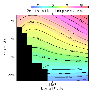
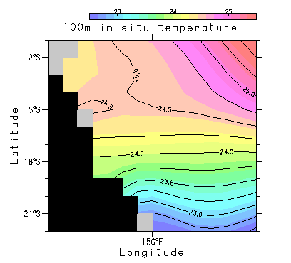
| Temperature |
|
| Description |
The Northeast Australia Large Marine Ecosystem owes its unity to the South Equatorial Current, a part of the Pacific Ocean counterclockwise gyre, and to the Great Barrier Reef system (GBR), a system of coral reefs that stretches 2,000 km along Australia’s northeast coast and covers an area of about 350,000 km2. The width of the GBR varies from 50 km in the north to 200 km in the South. It is the largest system of corals and related life forms in the world. The Northeast Australia LME is bounded by the Coral Sea to the East, and by the Torres Strait to the North. Tropical cyclones are common seasonal events in this LME. Cyclones exert pronounced effects on the continental shelf and on coastal marine ecosystems. The rainfall that accompanies cyclonic weather systems can be a major source of freshwater to the region, causing widespread though episodic flooding (http://na.nefsc.noaa.gov/lme/text/lme40.htm). |
| Comments on faunal list |
Area from SAU (November 2015). |
| URL 1 |
http://www.seaaroundus.org/lme/40.aspx |
| URL 2 |
|
| Ecosystem Checklist Link |
|
| Total |
|
Species |
Families |
Species |
Families |
Reference |
|
1660 |
170 |
|
|
|
|