More Info
Pictures available for Hyporhamphus limbatus.       iNaturalist images  |  iNaturalist observations  |  Google Images
(Click on picture to enlarge and see data)
NEW! Upload your photos and videos for this fish     |    FishBase


tn_Hylim_u0.jpgHylim_u0.jpgPhoto by Randall, J.E.
India, by Randall, J.E. (Hylim_u0.jpg)
tn_Hylim_u1.jpgHylim_u1.jpgPhoto by Hermosa, Jr., G.V.
Oman, by Hermosa, Jr., G.V. (Hylim_u1.jpg)
tn_Hylim_u2.jpgHylim_u2.jpgPhoto by Ratmuangkhwang, S.
Thailand, by Ratmuangkhwang, S. (Hylim_u2.jpg)
tn_Hylim_u0.gifHylim_u0.gifPhoto by FAO
by FAO (Hylim_u0.gif)

Note: the photos shown on this page are low resolution scans in high compression JPEG format. The copyright remains with the photographers/institutes. Click on the image to see individual license applicable to each picture.

Photos uploaded by FishBase users
Upload more photos of this fish
n=6
For comments, corrections please contact Aque Atanacio
(Fish identification given by uploader of photo)
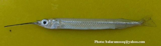
../tools/UploadPhoto/uploads/Hemiramphus_limbatus.jpg Photo by Balaram Mahalder
Bangladesh, Sunamganj, 22.01.2008, by Balaram Mahalder

../tools/UploadPhoto/uploads/Hemiramphus_limbatus2.jpg Photo by Balaram Mahalder
Bangladesh, by Balaram Mahalder

../tools/UploadPhoto/uploads/Hyporhamphus-limbatus-Otolith.jpg Photo by MUNTAZ KHAN
India, Hyporhamphus limbatus (Otolith) Chilika lagoon Odisha India, 05.08.2007, by MUNTAZ KHAN
CC-BY
../tools/UploadPhoto/uploads/1639722816_172.68.155.165.jpg Photo by Ranjit M More
India, by Ranjit M More
CC-BY
../tools/UploadPhoto/uploads/1652158869_172.70.214.31.jpg Photo by Durairaja Ramulu, Jawahar Paulraj and Jayakumar Natarajan
India, The potamon zone of Thamirabarani River (Latitude 08° 37.936’ N, Longitude 077° 52.499′ (Puliyangulam) and Latitude 08° 38.753' N, Longitude 077° 52.499'E (Karungulam)) , 20.03.2021, 16 cm and 7.0 g, by Durairaja Ramulu, Jawahar Paulraj and Jayakumar Natarajan
CC-BY
../tools/UploadPhoto/uploads/1652159191_172.70.214.31.jpeg Photo by Durairaja Ramulu, Jawahar Paulraj and Jayakumar Natarajan
India, The potamon zone of Thamirabarani River (Latitude 08° 37.936’ N, Longitude 077° 52.499′ (Puliyangulam) and Latitude 08° 38.753' N, Longitude 077° 52.499'E (Karungulam)) , 20.03.2021, 16 cm and 7.0 g, by Durairaja Ramulu, Jawahar Paulraj and Jayakumar Natarajan


Note: the photos shown on this page are low resolution scans in high compression JPEG format. The copyright remains with the photographers/institutes. If you want to use any of the photos/drawings, please contact the contributor for permission. However, we would appreciate a proper indication of the source. For other drawings where the originating publication is given, you have to ask the publisher and the author for permission to use those drawings.